shearing_deformation#
- metpy.calc.shearing_deformation(u, v, dx=None, dy=None, x_dim=-1, y_dim=-2, *, parallel_scale=None, meridional_scale=None, latitude=None, longitude=None, crs=None)[source]#
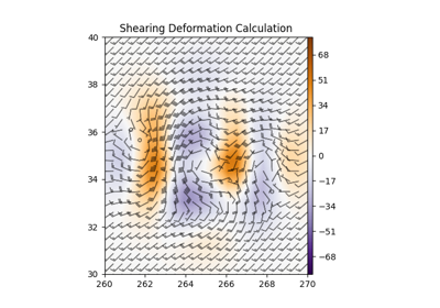
Calculate the shearing deformation of the horizontal wind.
- Parameters:
u ((…, M, N)
xarray.DataArrayorpint.Quantity) – x component of the windv ((…, M, N)
xarray.DataArrayorpint.Quantity) – y component of the winddx (
pint.Quantity, optional) – The grid spacing(s) in the x-direction. If an array, there should be one item less than the size of u along the applicable axis. Optional ifxarray.DataArraywith latitude/longitude coordinates used as input.dy (
pint.Quantity, optional) – The grid spacing(s) in the y-direction. If an array, there should be one item less than the size of u along the applicable axis. Optional ifxarray.DataArraywith latitude/longitude coordinates used as input.x_dim (int, optional) – Axis number of x dimension. Defaults to -1 (implying […, Y, X] order). Automatically parsed from input if using
xarray.DataArray.y_dim (int, optional) – Axis number of y dimension. Defaults to -2 (implying […, Y, X] order). Automatically parsed from input if using
xarray.DataArray.parallel_scale (
pint.Quantity, optional) – Parallel scale of map projection at data coordinate. Optional ifxarray.DataArraywith latitude/longitude coordinates and MetPy CRS used as input. Also optional if longitude, latitude, and crs are given. If otherwise omitted, calculation will be carried out on a Cartesian, rather than geospatial, grid. Keyword-only argument.meridional_scale (
pint.Quantity, optional) – Meridional scale of map projection at data coordinate. Optional ifxarray.DataArraywith latitude/longitude coordinates and MetPy CRS used as input. Also optional if longitude, latitude, and crs are given. If otherwise omitted, calculation will be carried out on a Cartesian, rather than geospatial, grid. Keyword-only argument.latitude (
pint.Quantity, optional) – Latitude of data. Optional ifxarray.DataArraywith latitude/longitude coordinates used as input. Also optional if parallel_scale and meridional_scale are given. If otherwise omitted, calculation will be carried out on a Cartesian, rather than geospatial, grid. Keyword-only argument.longitude (
pint.Quantity, optional) – Longitude of data. Optional ifxarray.DataArraywith latitude/longitude coordinates used as input. Also optional if parallel_scale and meridional_scale are given. If otherwise omitted, calculation will be carried out on a Cartesian, rather than geospatial, grid. Keyword-only argument.crs (
pyproj.crs.CRS, optional) – Coordinate Reference System of data. Optional ifxarray.DataArraywith MetPy CRS used as input. Also optional if parallel_scale and meridional_scale are given. If otherwise omitted, calculation will be carried out on a Cartesian, rather than geospatial, grid. Keyword-only argument.
- Returns:
(…, M, N)
xarray.DataArrayorpint.Quantity– Shearing Deformation
Changed in version 1.0: Changed signature from
(u, v, dx, dy)See also