Click here to launch an
interactive online version of this notebook:
Case study of 2018 600dam ridge July 2018
Selected because GFS forecast, Lance email to MAP
Human readable. To reproduce or operate this Jupyter notebook, you need to have installed The IDV, Anaconda, and set up a few necessary things for the DRILSDOWN package, as explained at https://unidata.github.io/drilsdown/quickstart
Sections within this notebook
The story, with Web and journalism links
The meteorology: large-scale 2D flow evolution
The meteorology: analyses of 3D fields
The meteorology: clouds and rain, connection to soundings, etc.
The story, with Web and journalism links:
It’s a forecast.
And a MAP email topic
</ul>
The explanation for high heights
is anticyclonic flow, especially on a large scale.
$ Z \approx `:nbsphinx-math:nabla`^{-2} \zeta_{rel} $
But absolute vorticity is more conserved, so we plot that:
$ \zeta{abs} = f+ :nbsphinx-math:`zeta`{rel} $
Simple Gaussian smoothing is used, a poor man’s version of \(\nabla^{-2}\)
[ ]:
The meteorology, with IDV images:
Examine the 2D fields and get a good understanding of your case.
Illustrate your clear verbal description.
</ul>
[2]:
%reload_ext ipython_IDV
The 500 mb heights
[5]:
%make_image -capture legend -caption 'The ridge'
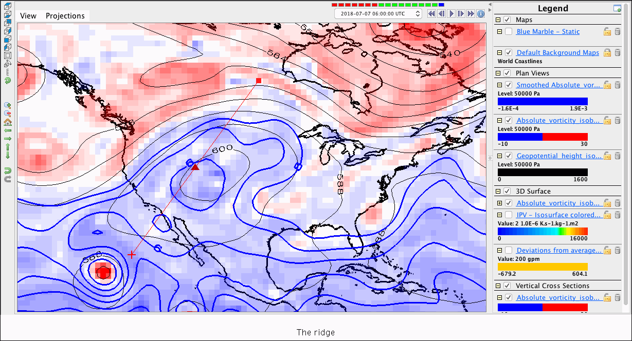
The anticyclone in the Southwest is clear (Z > 600 dam)
[6]:
# Moving image
%make_movie -capture legend -caption 'Absolute vorticity evolution'
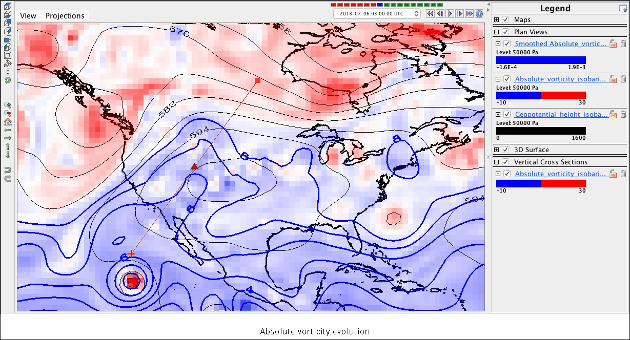
Apparently the blue ink flows northward ahead of the west coast trough. The more-smoothed blue contour helps you see the average despite the convective dipoles that appear in the afternoons.
Top
## The meteorology: analyses of 3D fields
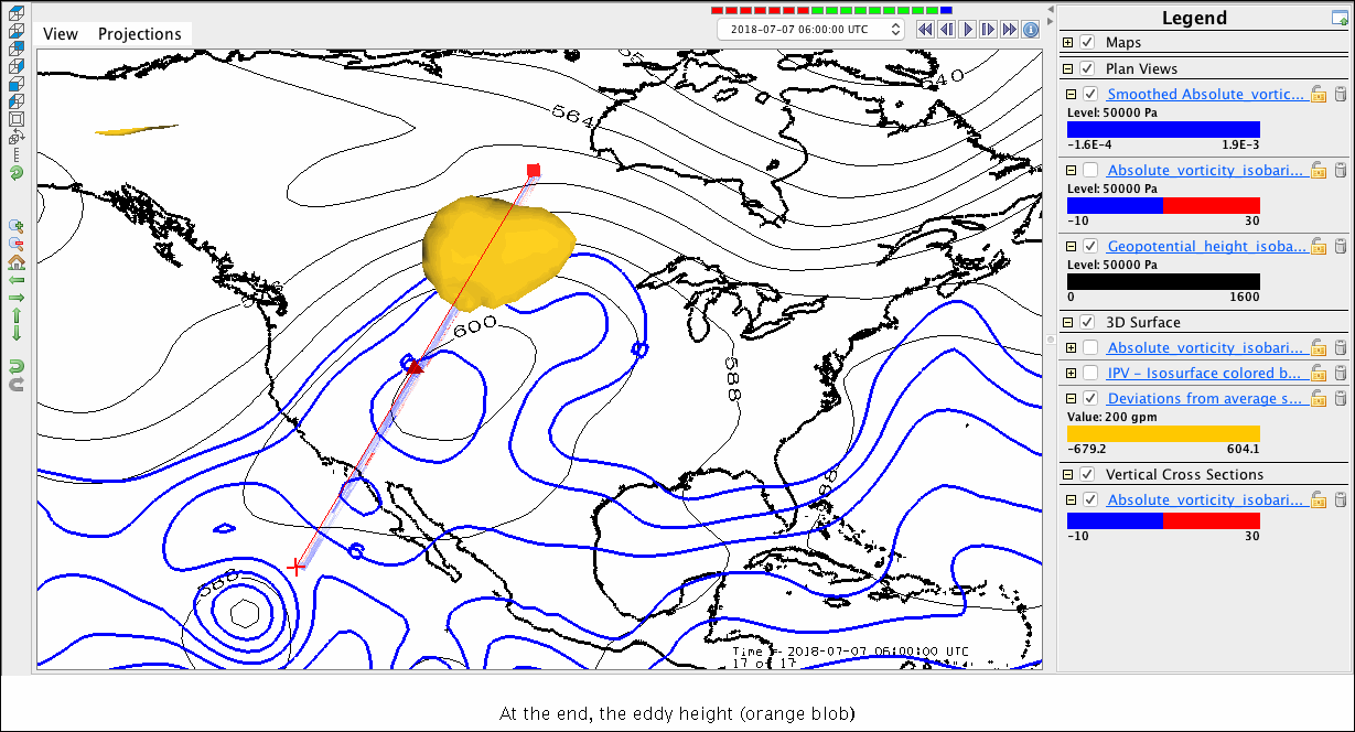
Note: Load the 3D bundle, and use the 3D isosurface to understand the 3D strcture of the vortices you saw at 500 mb.
Tell the story
[2]:
%make_image -capture legend -caption 'At the end, the eddy height (orange blob)'
[4]:
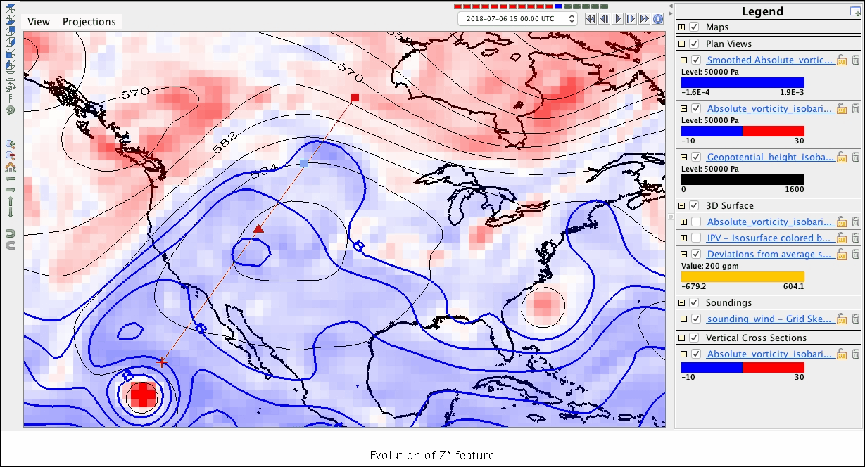
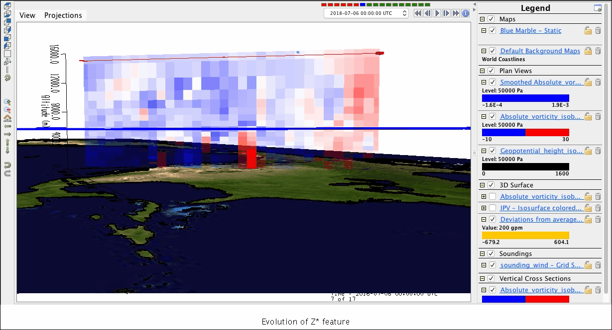
# Moving image
%make_movie -capture legend -caption 'Evolution of Z* feature'
[3]:
%make_movie -capture legend -caption 'Evolution of Z* feature'
Top
Clouds and rain and connection to soundings (thermo):
Sounding capture (I had to set the display ID on the sounding window’s Preferences menu item)
[8]:
%make_image -display sounding -caption 'Sounding at blue dot location'
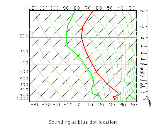
But I don’t much like skew-T plots, especially for water vapor. (See better sounding plot if you care).
[9]:
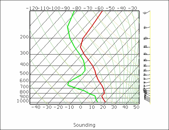
# Moving image
%make_movie -display sounding -caption 'Sounding'
Meaning:
Anticyclonic relative vorticity, largely due to poleward transport of upper-level low absolute vorticity from the subtropics, built a ridge with dry hot weather.
[4]:
# Capture bundle for replicability (although data source is "current"
# so this won't really be replicable -- just the same displays
# for the day you run it. Oh well.
%save_bundle -embed
[11]:
!date
Wed Jun 27 14:55:25 MDT 2018
Top