Click here to launch an
interactive online version of this notebook:
Was Hurricane Dorian related to Spanish floods of Sept 2019?
Global: GFS analyses at 1 degree (500mb Z and vorticity)
Regional: GEOS-5 analyses at 1/4 degree and surface stations
Notebook from the Earthcube-supported DRILSDOWN project
This is a DRILSDOWN project notebook, capturing images from an IDV analysis. To reproduce or operate this Jupyter notebook, you need to have installed The IDV, Anaconda, and set up a few necessary things for the DRILSDOWN package, as explained at https://unidata.github.io/drilsdown/quickstart
Sections within this notebook
The story, with Web and journalism links
The meteorology: large-scale 2D flow evolution
The meteorology: close up in Spain (GEOS-5 analysis and surface data)
The story, with Web and journalism links:
Terrible floods in eastern Spain after hurricane Dorian hit Canada. Any connection?
</ul>
The meteorology, with IDV images:
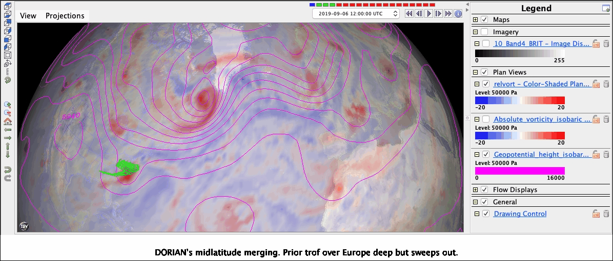
Dorian merges with extratropical vort500 Sept. 8 00-12Z
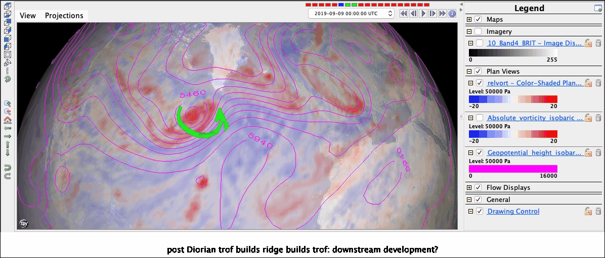
Downstream ridge + trof amplify
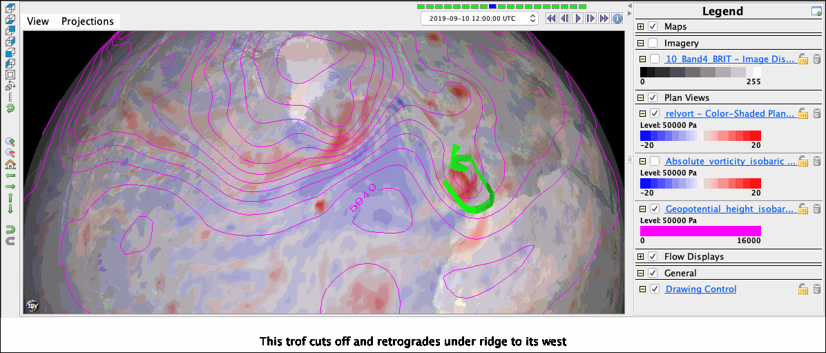
Trough cuts off Sept 10 0-12Z into Mediterranean latitude
Cutoff becomes stationary as it + ridge rotate into blocking configuration
Floods on Spain’s east coast with onshore winds, cool-core/lifting effects
</ul>
[4]:
%reload_ext ipython_IDV
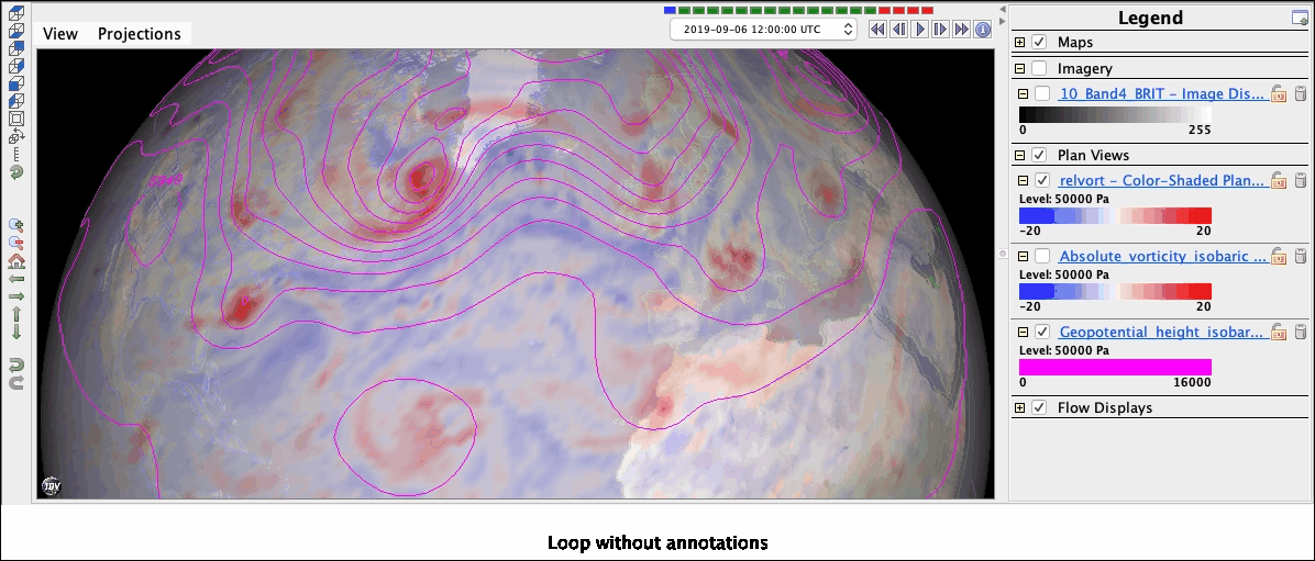
Loop without annotation
[4]:
%make_movie -capture legend -caption 'Loop without annotations'
[7]:
%make_movie -capture legend -caption "DORIAN's midlatitude merging. Prior trof over Europe deep but sweeps out."
[9]:
%make_movie -capture legend -caption 'post-Diorian trof builds ridge builds trof: downstream development?'
[11]:
%make_image -capture legend -caption 'This trof cuts off and retrogrades under ridge to its west'
[13]:
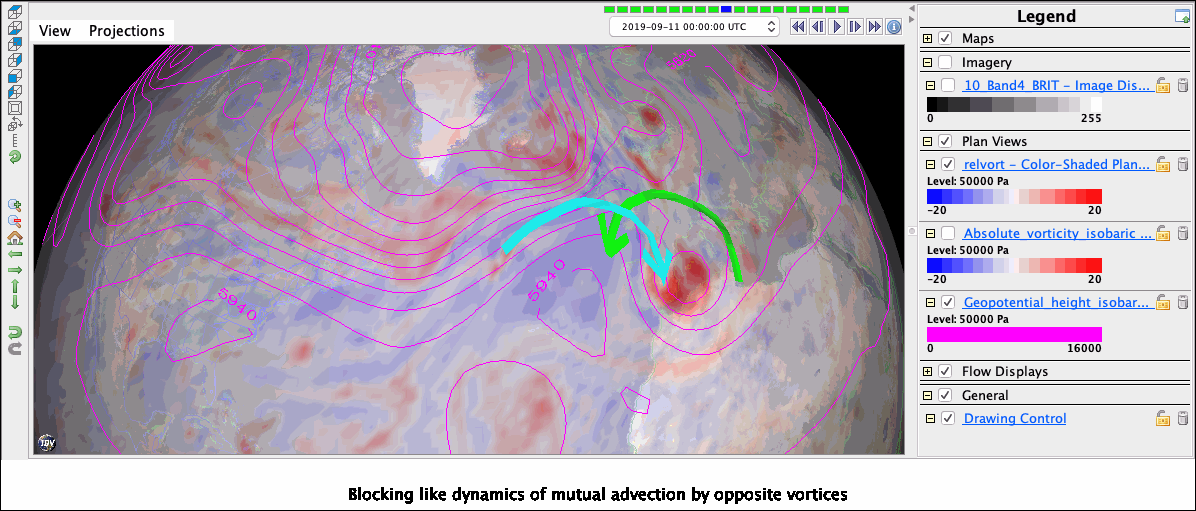
%make_image -capture legend -caption 'Blocking-like dynamics of mutual advection by opposite vortices'
[14]:
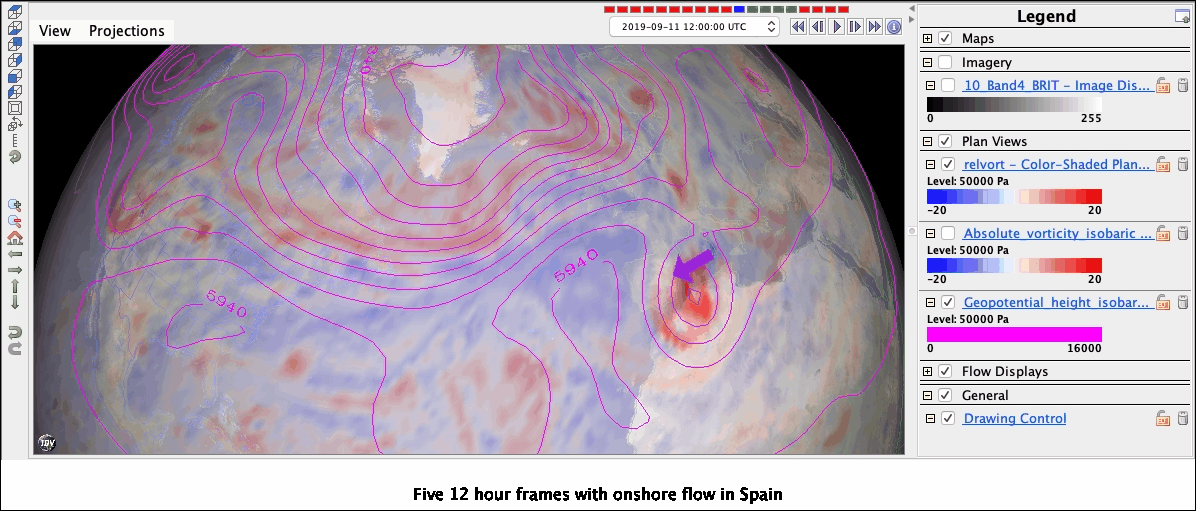
%make_movie -capture legend -caption 'Five 12-hour frames with onshore flow in Spain'
[11]:
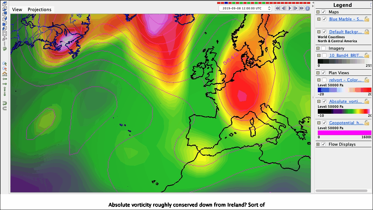
%make_movie -capture legend -caption 'Absolute vorticity roughly conserved down from Ireland? Sort of'
[12]:
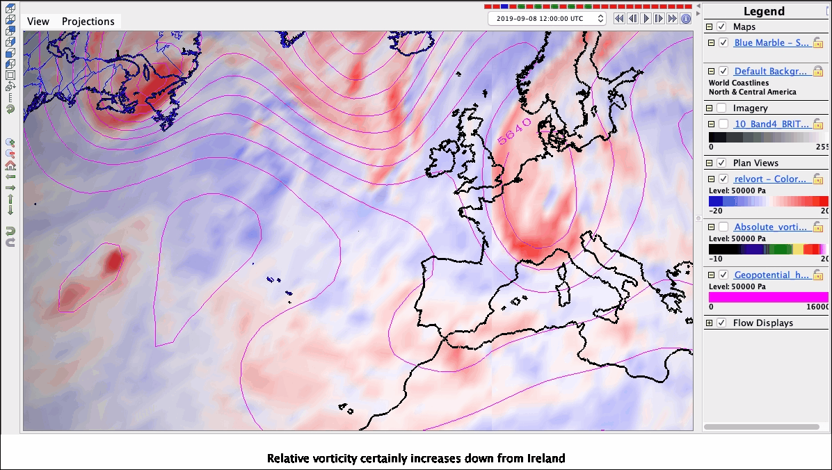
%make_movie -capture legend -caption 'Relative vorticity certainly increases down from Ireland'
Top
## The meteorology: closer view of Spain and North Africa
Note: This IDV bundle uses GEOS-5 data at 1/4 degree, because it doesn’t have GFS’s longitude seam at 0E. dods://opendap.nccs.nasa.gov/dods/GEOS-5/fp/0.25_deg/assim/inst3_2d_asm_Nx
[5]:
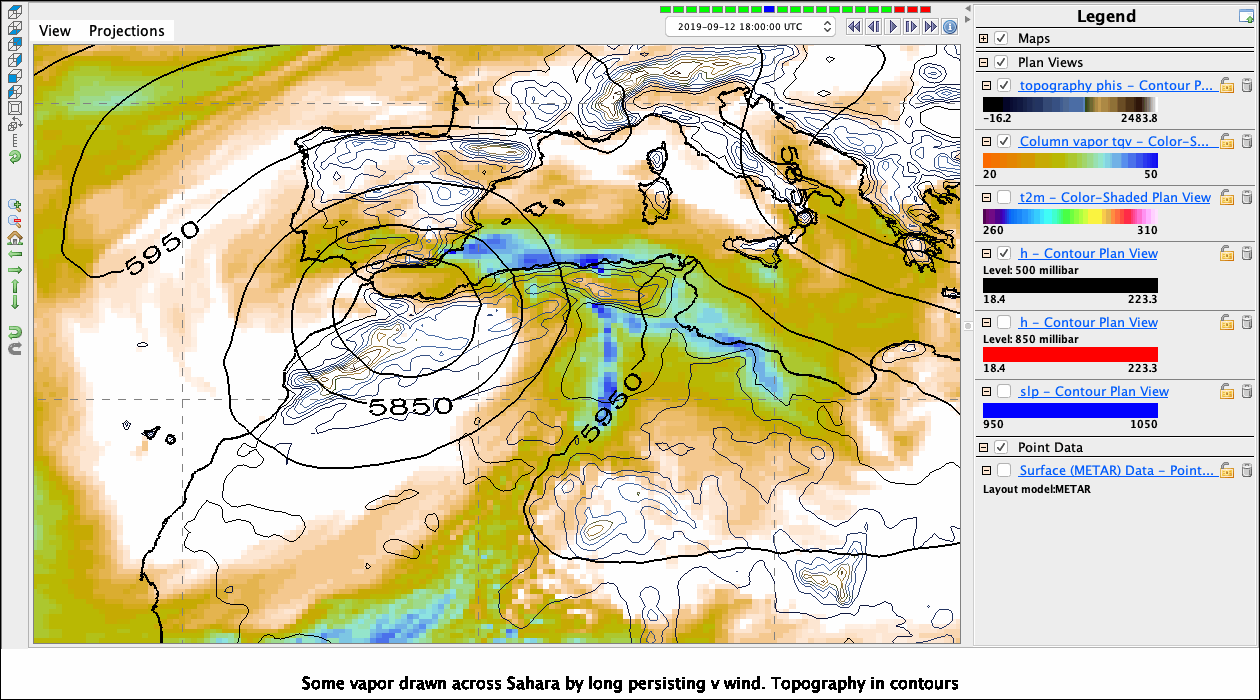
%make_image -capture legend -caption 'Some vapor drawn across Sahara by long-persisting v wind. Topography in contours'
[6]:
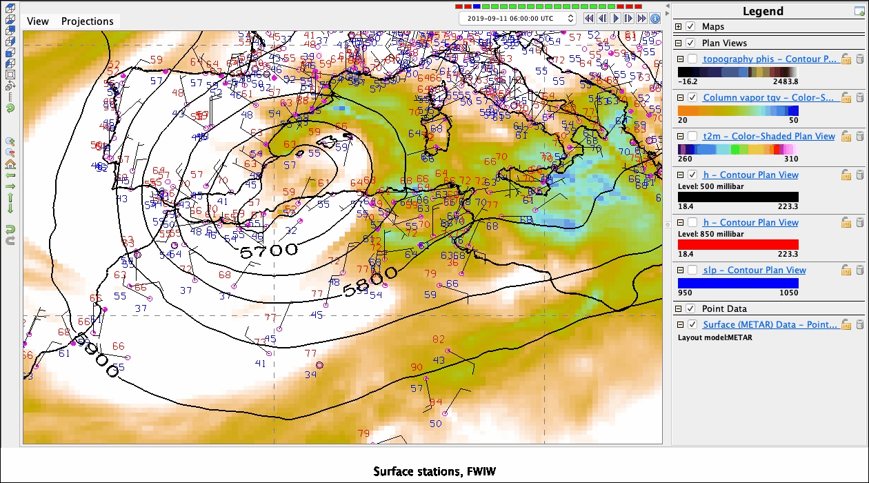
%make_movie -capture legend -caption 'Surface stations, FWIW'
[7]:
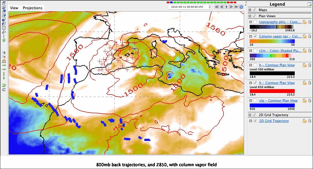
%make_movie -capture legend -caption '800mb back trajectories, and Z850, with column vapor field'
[8]:
!date
Sun Sep 15 15:45:29 EDT 2019
[2]:
%make_image
UsageError: Line magic function `%make_image` not found.
Top