Click here to launch an
interactive online version of this notebook:
Cyclone Idai in Mozambique (3/14/2019 18UTC landfall)
Selected because: tragic consequences
GFS analyses at 0.5 degree resolution (winds and heights at 850mb), column water vapor, and IR cloud imagery.
Notebook from the Earthcube-supported DRILSDOWN project
This is a DRILSDOWN project notebook, capturing images from an IDV analysis. To reproduce or operate this Jupyter notebook, you need to have installed The IDV, Anaconda, and set up a few necessary things for the DRILSDOWN package, as explained at https://unidata.github.io/drilsdown/quickstart
Sections within this notebook
The story, with Web and journalism links
The meteorology: large-scale 2D flow evolution
The meteorology: analyses of 3D fields
The story, with Web and journalism links:
Terrible tragedy in Mozambique
</ul>
The meteorology, with IDV images:
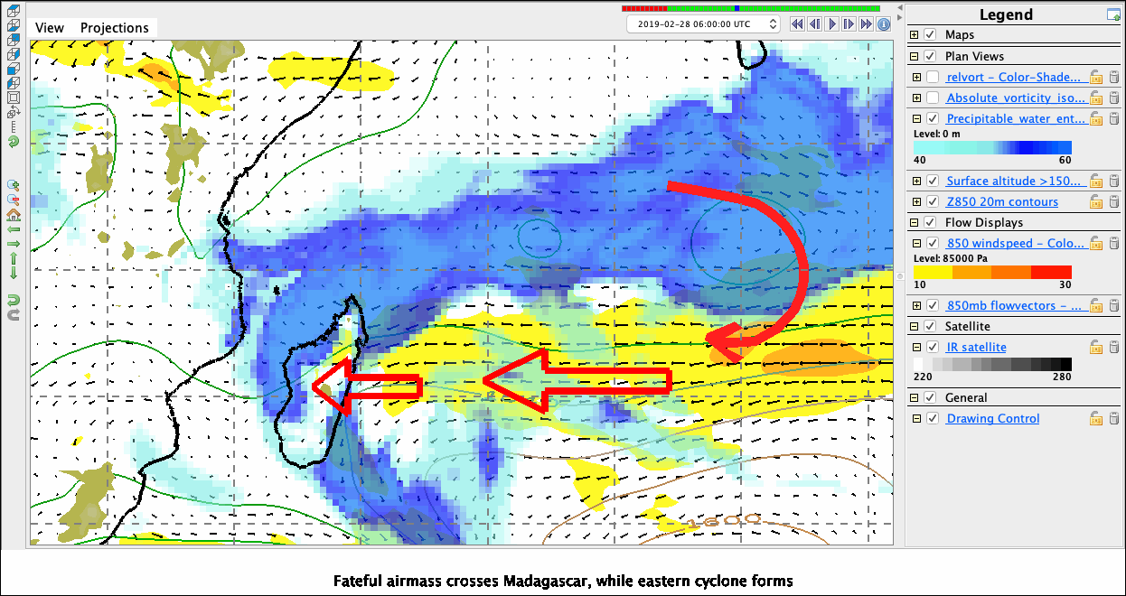
Trade surge 2/25-2/28 pushes air with CWV>50mm (envelope for tropical convection) over Madagascar.
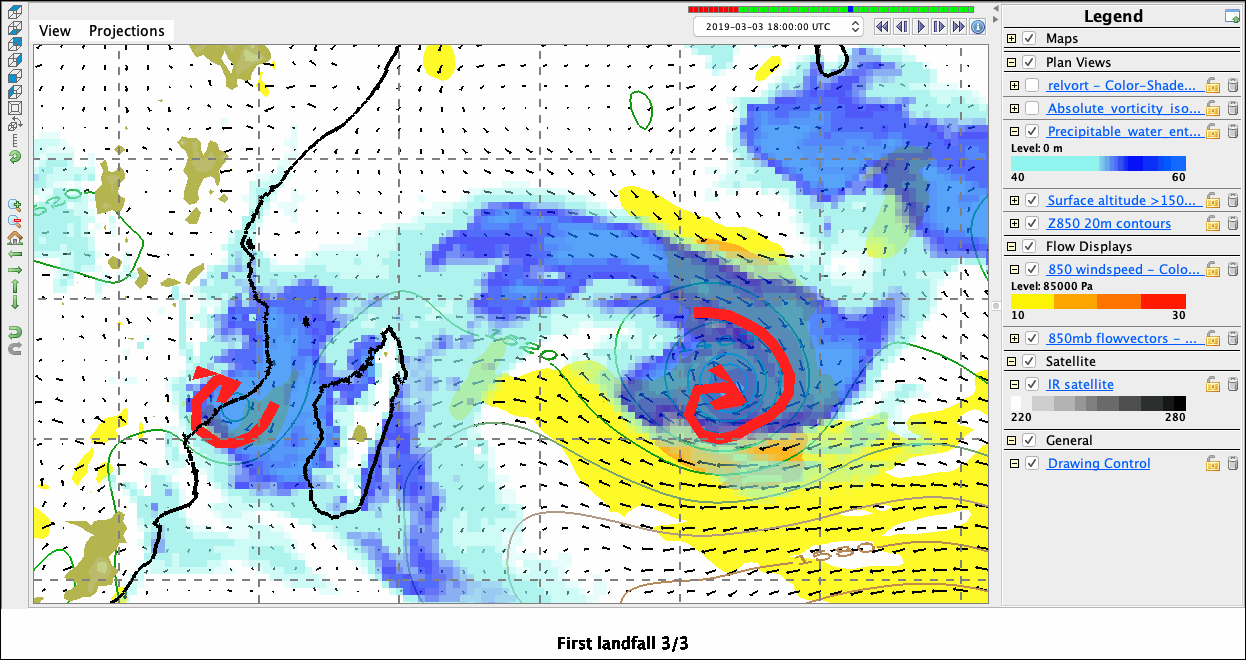
Moist airmass in Madagascar channel spins up coastal cyclone 3/3, which drifts inland
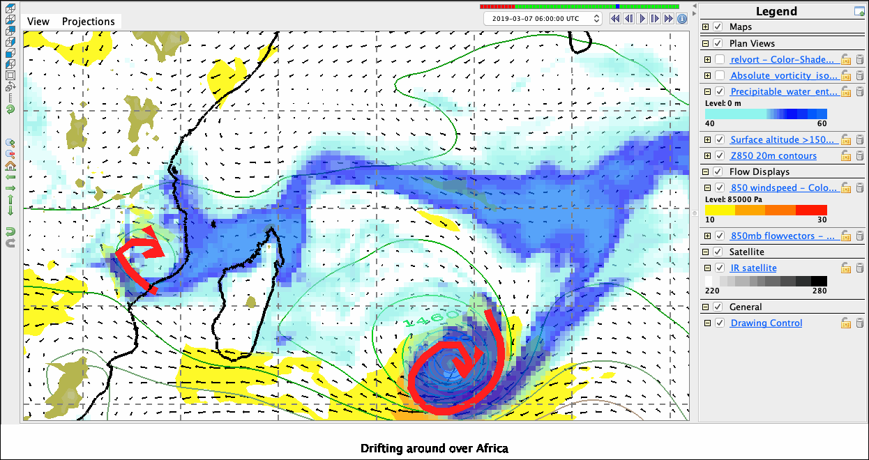
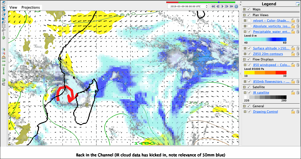
Weak recirculation brings it back offshore
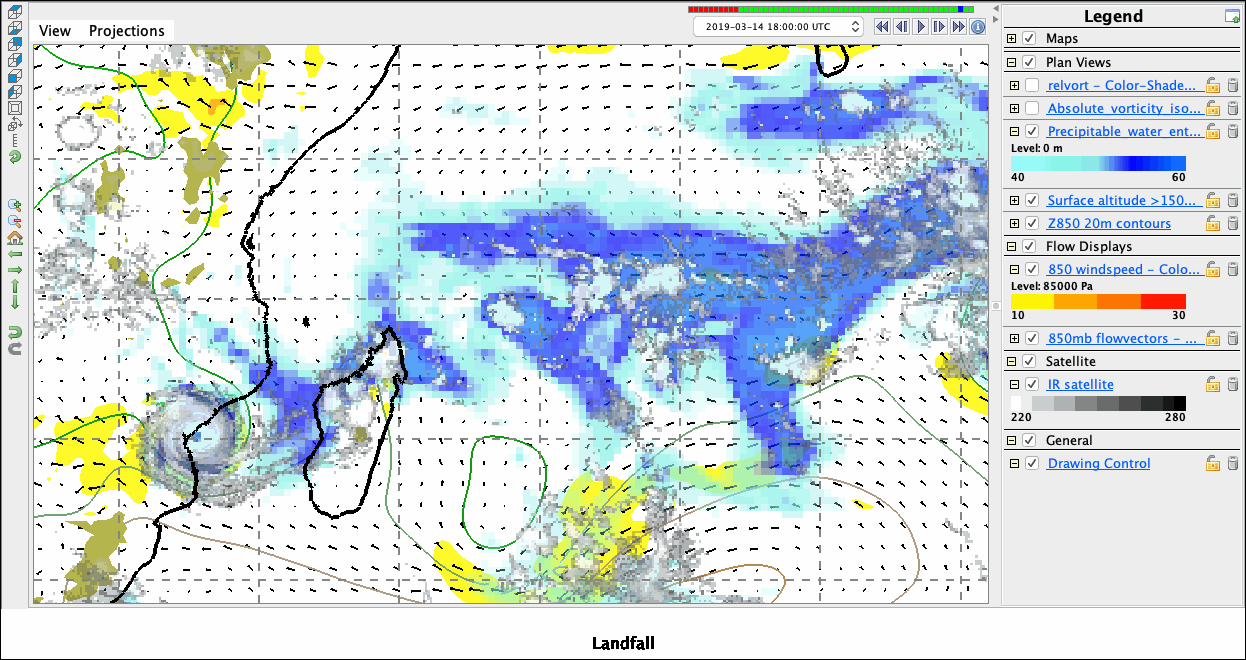
Slight midlatitude pulse on 3/12 helps it intensify, then it landfalls as Cat 3
</ul>
[1]:
%reload_ext ipython_IDV
850 hPa Z and winds, and PW with 50mm emphasized
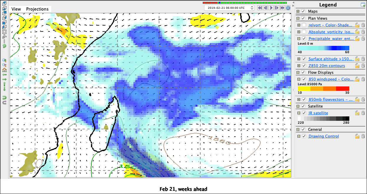
Much earlier: quiescent basin, but NH trade surge begins
[3]:
%make_image -capture legend -caption 'Feb 21, weeks ahead'
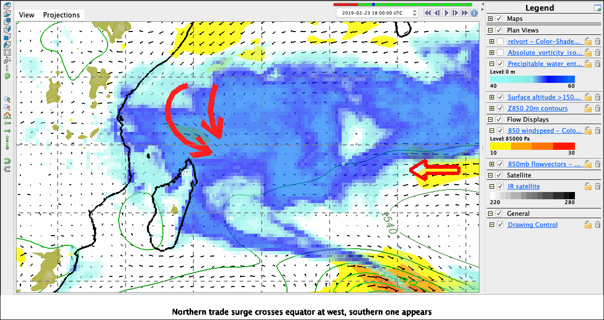
[6]:
%make_image -capture legend -caption 'Northern trade surge crosses equator at west, southern one appears'
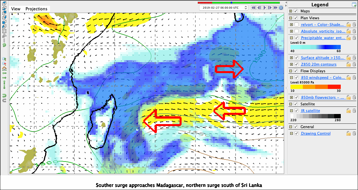
[19]:
%make_image -capture legend -caption 'Souther surge approaches Madagascar, northern surge south of Sri Lanka'
[8]:
%make_image -capture legend -caption 'Fateful airmass crosses Madagascar, while eastern cyclone forms'
[9]:
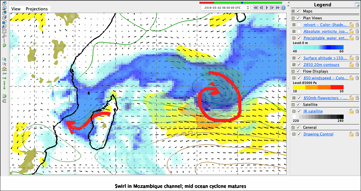
%make_image -capture legend -caption 'Swirl in Mozambique channel; mid-ocean cyclone matures'
[10]:
%make_image -capture legend -caption 'First landfall 3/3'
[11]:
%make_image -capture legend -caption 'Drifting around over Africa'
[13]:
%make_image -capture legend -caption 'Back in the Channel. IR cloud data now: Note relevance of 50mm (dark blue)'
[14]:
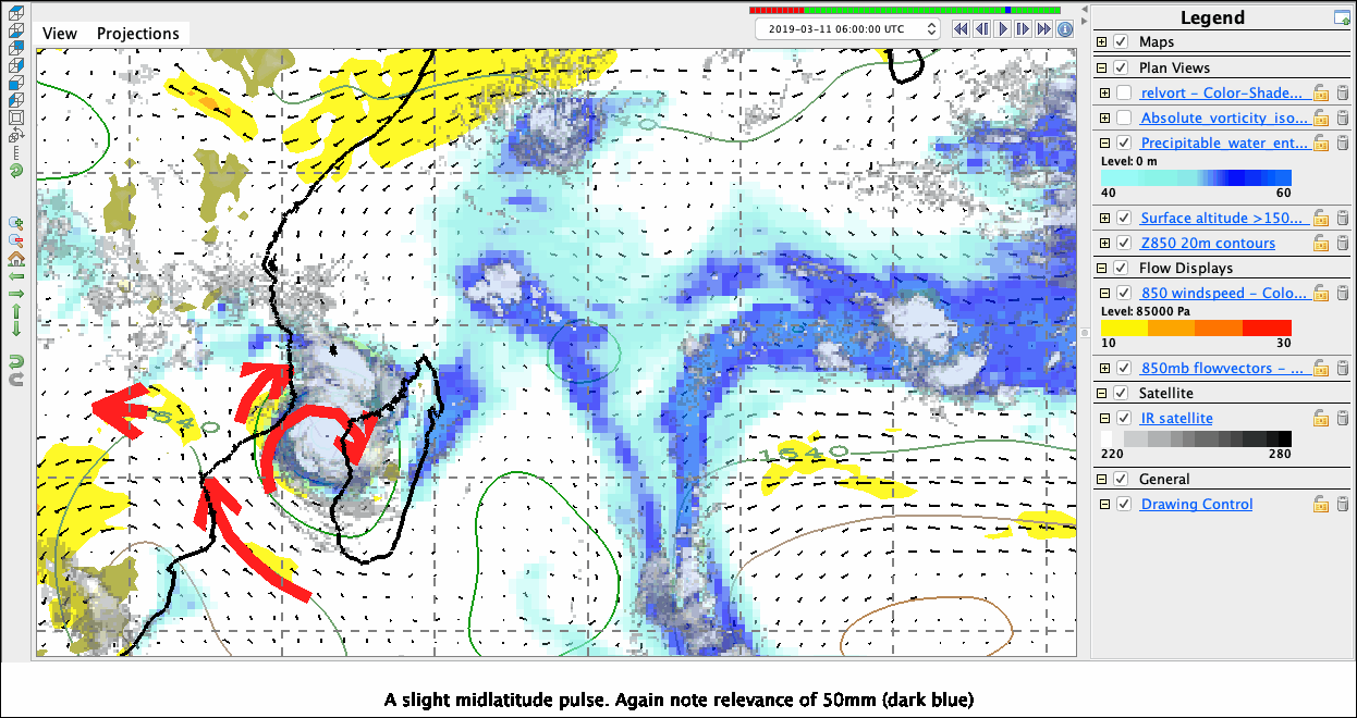
%make_image -capture legend -caption 'A slight midlatitude pulse. Again note relevance of 50mm (dark blue)'
[15]:
%make_image -capture legend -caption 'Wicked eye. Bad news.'

[16]:
%make_image -capture legend -caption 'Landfall'
[17]:
# Moving image
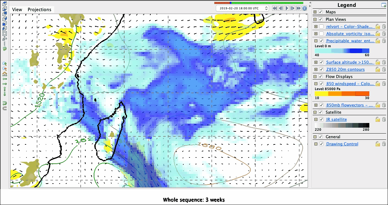
%make_movie -capture legend -caption 'Whole sequence: 3 weeks'
Top
## The meteorology: analyses of 3D fields, etc.
Note: Nothing especially 3D about all this.
[18]:
!date
Tue Mar 19 19:16:35 EDT 2019
Top