Any GEMPAK grid file can be directly read and used by the GDFILE definition in the GD comman line programs. NMAP2 requires entries in two tables in order for load, view, loop and export new grids.
The Ocean Prediction Center lightning strike density fields are provided as grib2 and GEMPAK grid files, each with a single grid, parameter name LTNG. Like any GEMPAK grid file they can be directly defined by GDFILE in any of the GD programs.
Using the OPC Lightning Strike Density Grids as an example, each file contains a single grid with parameter name LTNG. For the two restore files provided by OPC, we add entries to mod_res.tbl.
! PRODUCT NAME       PATH/FILENAME                            GROUP    MODELS
LTNG_DENSITY_CONTOUR $NMAP_RESTORE/stnd/ltng_density_contour  standard opcltng
LTNG_DENSITY_FILLED  $NMAP_RESTORE/stnd/ltng_density_filled   standard opcltng
Unlike datatype.tbl, the columns in mod_res.tbl are not in fixed locations.
PRODUCT NAME as it is to appear in NMAP2PATH/FILENAME is the path to the GEMPAK nts file that NMAP2 will use for this grid.GROUP name under which the product is to appearMODELS is a list of models for which this restore file will appear, in this case only one.If you want to use an existing restore file, it's as easy as copying the name from another entry in datatype.tbl.
If you want to add a restore file, you need to move it to the PATH/FILENAME defined for the grid.
The second file to edit is datatype.tbl. An entry must exist with the same model name as defined in mod_res.tbl. For lightning strike density grids, the OPCLTNG entry is:
!FILE TYPE  |PATH                     |FILE TEMPLATE                 |CATEGORY|SUBCAT  |#FRM|RANGE |INTRVL|BIN HRS              |MATCH
!(12)       |(25)                     |(48)                          |(8)     |(8)     |(4) |(6)   |(6)   |(21)                 |(6)
!           |                         |                              |        |        |    |             |                     |
OPCLTNG     $MODEL/opcltng            YYYYMMDDHHNN.30.grd            CAT_GRD  SCAT_ANL    -1    720     1  OFF/0/0               4
You can scroll to the right inside the "code window" above to see (and Copy/Paste) the entire table entry. The columns are fixed, unlike mod_res.tbl, so you must use standard formatting within this file. Use other entries as a guide when adding a new line.
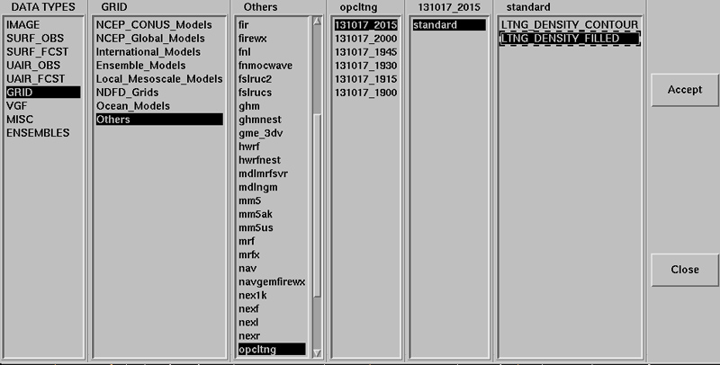
PATH is where the OCP lightning GEMPAK grid files are stored.FILE TEMPLATE is the format of grid file naming. For example, YYYYMMDDHHNN.30.grd for files named 201310172030.30.grd for 2030 UTC October 17 2013.CAT_GRD is for NMAP2 grid menus. SCAT_ANL is for analysis subcategoryAfter making the above table additions, re-start NMAP2 and open the data loader from GRID -> Others -> opcltng -> date/time -> standard ->

In the data time selection window you will see three times

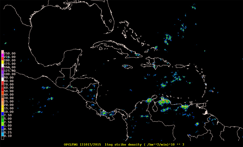
Select LOAD and adjust the Map to outside North America if there are no visible contours of lightning strike density.

For the above colored plot, $NMAP_RESTORE/stnd/ltng_density_filled
!
! Restore File : ltng_density_filled
!
! Log:
! M.Mainelli/TPC     09/2004  Initial creation
! J.M.Sienkiewicz/OPC 10/2008 adapted to colors for altimeter wave heights
! J.M.Sienkiewicz/OPC 2/2013 adapted for display of ltng density 10**3
!
    GLEVEL  0
    GVCORD  none
    PANEL   0
    SKIP    0
    SCALE   3
    GDPFUN  ltng
    TYPE    f
    CONTUR  0
    CINT
    LINE
    FINT    0.10;0.25;0.5;1;2.5;5;7.5;10;15;20;25;30;40;50;60;70;80;90;100;125;150;175;200;225;250
    FLINE   0;26;24;4;21;22;23;4;20;19;10;9;8;16;15;14;13;31;28;29;30;31;20;13;7;11
    HILO    0
    HLSYM   0
    CLRBAR  1
    WIND
    REFVEC
    TITLE   5/1/~  ltng strike density ( /km**2/min)*10 ** 3
    TEXT    1/21/1/hw
    CLEAR   yes
    STNPLT
    SATFIL
    RADFIL
    STREAM
    POSN    4
    COLORS  2
    MARKER  2
    GRDLBL  5
    LUTFIL  none
    FILTER  yes
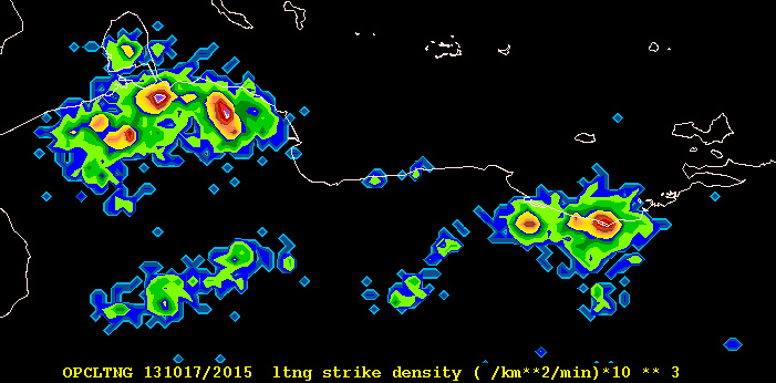
This nts file will draw color-filled contours for lightning strike density in units strikes per square kilometer per minute: (/km**2/min)*10**3 in GEMPAK.

In GDINFO you can see the contents of a lightning density
GDFILE   = 201310171800.30.grd
LSTALL   = YES
OUTPUT   = T
GDATTIM  = all
GLEVEL   = all
GVCORD   = all
GFUNC    = all
After running GDINFO we see the grid navigation/ Notice the grid size.
GRID FILE: 201310171800.30.grd

GRID NAVIGATION:
    PROJECTION:          CED
    GRID SIZE:         34761460
    LL CORNER:             -25.00    110.00
    UR CORNER:              80.00      0.00

GRID ANALYSIS BLOCK:
    ANALYSIS TYPE:        BARNES
    DELTAN:               4.000
    DELTAX:           -9999.000
    DELTAY:           -9999.000

Number of grids in file:     1
Maximum number of grids in file:   2000

NUM       TIME1              TIME2           LEVL1 LEVL2  VCORD PARM
1     131017/1800                              0         NONE LTNG